Satellite Image
Images taken by satellites can provide useful context and analysis for human rights reports. Satellite images have been used to show where incidents have taken place, where researchers have visited, and as a base map for pointing out other sites of importance.
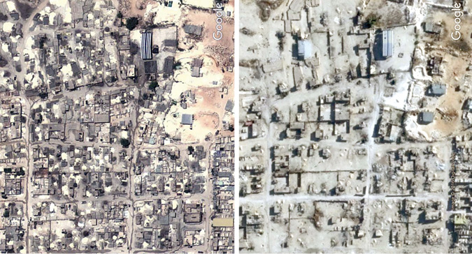
Satellite imagery has been a particularly powerful tool for showing large-scale infrastructure changes before and after human rights incidents—for instance, the destruction of housing or the growth of refugee camps or other informal housing.
Analyses of infrared satellite imagery can illuminate changes to vegetation due to a drought or reveal tracks of vehicles through fields.
Since the 1990's, high quality satellite imagery has become increasingly available to the public through web-based mapping programs as well as desktop GIS applications and Google Earth.